Yorkshire CD books
Old and rare Yorkshire books as pdf file downloads
Nidderdale, an historical, Topographical and Descriptive sketch of the valley of the Nidd. (1863)
by William Grainge
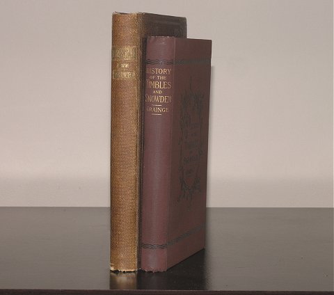
andThe History and Topography of Great Timble, Little Timble and Snowden.
by William Grainge
download version
produced by Yorkshire CD books ©
All our downloads are presented as scanned images in Adobe Acrobat (pdf) format.
We have now cleared all of our CDroms and now do downloads only.
Note that downloads are set up manually and therefore will not be instant.
Payment can be made either by a PayPal account, or with a Credit Card via PayPal
in your own currency, or by Sterling Cheque drawn on a UK bank.
Please see the ordering and payment information page
for details on methods of payment.
For
sample pages, please see the links to the Acrobat (pdf) files given below.
The data in this downloadable pdf is computer searchable.
"Nidderdale, an historical, Topographical and Descriptive sketch of the valley of the Nidd". (1863) includes Pateley Bridge, Bishopside, Dacre Banks, Hartwith, Brimham Rocks, Stonebeck Down, Ramsgill, Stonebeck up, Middlesmoor, Fountains Earch, Greenhow Hill, and the Stump Cross Caverns. The book contains lots of names of people, along with descriptions of pedigrees and other information of interest to Family History Researchers.
In order to give you a better idea of the information in the book the following items are available here on line:
"The History & Topography of the Townships of Little Timble, Great Timble and the Hamlet of Snowden" contains well over 200 pages and describes the villages and their more important inhabitants (past and present(1896)) in quite some detail. Both the contents pages and the index use active links to enhance the navigation of the book.
In order to give you a better idea of the information in the book the following items are available here on line:
The above Acrobat files were extracted from the main pdf file and show the quality of the images. You will need at least version 5 of Acrobat to open this file. If you do not have an up to date version please go to the Adobe web-site to obtain a free version of Acrobat Reader.
The Timbles and Snowden, list of contents:
- Situation.
- Boundaries.
- Geological Formation, Soil and Scenery
- Heights above Sea Level.
- Little Timble.
- The Legend of the building of Swinsty Hall
- The Family of Wood, of Swinsty.
- The Family of Robinson, of Swinsty Hall
- The Family of Bramley, of Swinsty Hall
- Swinsty Hall.
- Nether Timble.
- Swinsty Moor.
- Swinsty Tarn.
- Ancient British Celts Newhall.
- Edward Fairfax, of Newhall
- The Swinsty Reservoir.
- Little Timble in the Directories.
- Population, Statistics, & c.
- Great Timble. (2)
- Roman Road Timble cum Fewston.
- Encroachments within the Forest of Knaresbro'
- The Wastes of the Forest of Knaresborough.
- A Timble Charity, from the Fewston Register. to
- The Hearth Tax Roll, 1672.
-
|
- Bothams.
- An Ancient Earthwork.
- Shooting Extraordinary.
- Folk Lore.
- White Crag. I
- Field Lore.
- The Old School. (2)
- The Wesleyan Chapel, or School.
- The Robinson Library and Free School
- Mr. Robinson Gill.
- Dr. Robert Collyer
- Timble Families.
- Jerome Thackwray, the Timble Poet
- Fawkes, of Farnley, in Timble.
- The Village Water Supply.
- The Village Feast.
- The City of Refuge Friendly Society
- Thackwray.
- The Fewston Reservoir.
- Great Timble in the Directories.
- Population, Statistics, & c. (3)
- Snowden.
- Linley, of Snowden
- Topographical Tour
|
If you would prefer the real book(s), please contact The Idle Booksellers through their website.
Page last updated at 12.40 on Friday, 27 March 2026, ©2010
(This page will not be updated again unless the information on it is found to be incorrect).
For the latest update date for the site, please see our Home Page.